Mike Roche
‘Geography is about Maps’
— Edmund Clerihew Bentley, Biography for Beginners, 1905
Geography provides excellent ‘pub quiz’ fodder generating questions about the names of rivers, mountains, capital cities, and countries. An older generation who played ‘Trivial Pursuit’ may recall the ‘Geography’ option covering similar territory. This humorously limited depiction of the subject does admittedly have some basis in fact, but not in the 21st century or most of the 20th century.
Characterised as ‘Capes and Bays’ geography, it was a product of late 19th century British education systems that tended to reduce school geography to lists of physical features and names of towns and cities. This type of ‘geography’ instruction emerged as part of national education systems and, alongside history, was part of an effort to better educate the work force of industrialising Britain by providing useful knowledge about the world as well as adding to a sense of nationhood. The latter idea was more complex for lands within the British Empire.
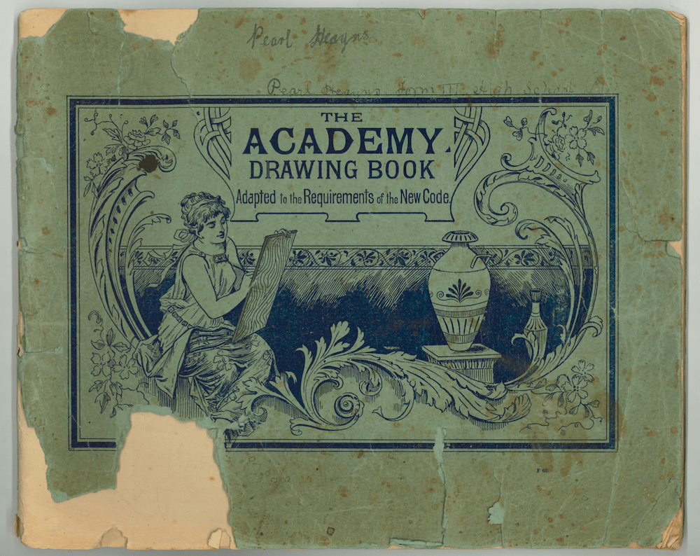
Secondary education did not become free in New Zealand until 1913. Geography was from earlier times part of the syllabus. Textbooks, mainly, but not exclusively, British, from the decades around the turn of the 20th century provide clues as to the thinking that lay behind the mapping exercises produced by local third former Pearl Heayns (1896–1993) in 1910.
Palmerston North High School, with tuition fees of £10 p.a., was among 31 secondary schools country-wide. It had begun to teach boys and girls in separate classes in 1909. There were 180 pupils in 1910, 110 boys and 70 girls along with 10 staff. Pearl was one of an intake of 38 new girls, part of a group of 32 aged between 12 to 15 years (the remainder were aged 16 plus). It is not clear who taught Pearl’s geography class; suffice to say that there was no university geography in New Zealand at the time, except for a paper in Commercial Geography for Bachelor of Commerce students. Her teacher would at best have encountered ‘geography’ at Teachers’ Training College.
A significant event occurred at Palmerston North High School on 5 April 1910. Fire destroyed most of the school leading to the Board of Governor’s reporting, somewhat understatedly, ‘the work of the school has suffered somewhat as compared to the previous year’.1 Joseph Pawelka, the alleged culprit, was jailed for arson and burglary, but escaped in 1912 and was never recaptured. Classes were shifted to the nearby technical school, but many classroom items, books and sports gear were lost in the fire.
How this affected the third form girls’ geography class is unknown. It is possible that the map drawing exercises Pearl and her classmates undertook were intended as an interim substitute for textbook based lessons. Geography, as was often the case, was not included in the subjects taken by the ‘highest classes’ at the school. The textbook used by Pearl was Longman Geography II, favoured by most New Zealand secondary schools at the time, with a focus on World, Europe, and British Empire geography and the map drawing exercises that approximate the scope of the book. Pearl’s 11 map exercises tend to be drawn in black ink, feature block capitals, along with pencil drawn hachures (short lines to indicate slope) for mountain ranges. As an exception the untitled map of France uses black and red ink. In the aftermath of the fire The Palmerstonian, the school’s magazine,noted even ink was in short supply which may explain its use here.

Pearl’s maps are listed as follows:
Map 1 no title [France, plus bits of Switzerland and Italy], no mark noted
Gulf, mountains, rivers, cities, countries coloured printing
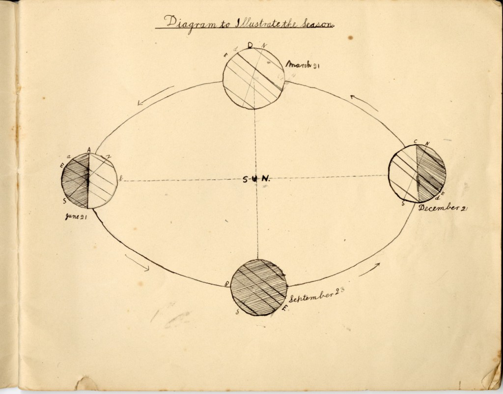
Map 2 ‘Diagram to illustrate Seasons’ [planetary movement], no mark noted
Map 3 no title [Belgium and Netherlands], no mark noted
Seas, rivers, islands, counties
Map 4 ‘Germany’, mark awarded 3
Rivers, cities, mountains
Map 5 ‘Austria Hungary’, no mark noted
Islands, lakes, rivers, forests, mountains, cities, country names, colour
Map 6 ‘Russia’, mark awarded 4
Seas, islands, lakes, mountains, rivers, cities
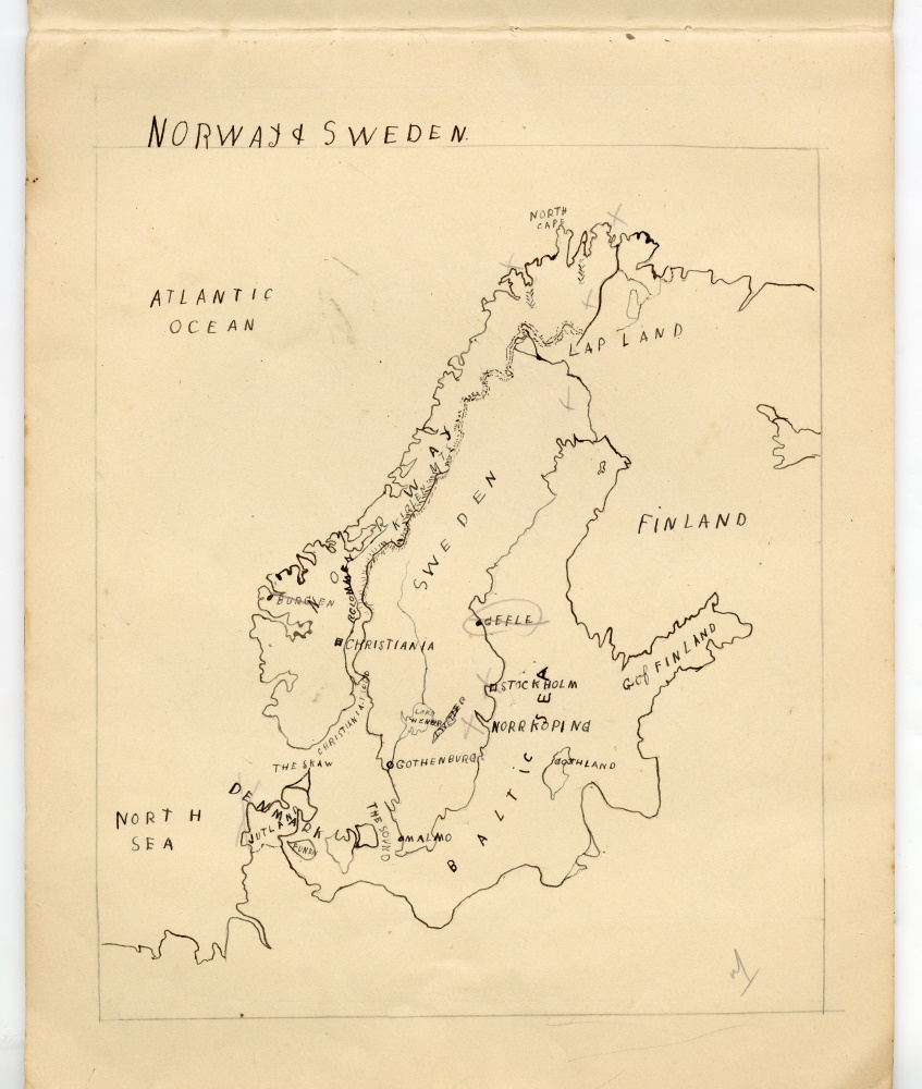
Map 7 ‘Norway and Sweden’, mark awarded 7
Ocean, seas, gulf, sounds, lakes, mountains, cities, country names
Map 8 ‘Spain and Portugal’, mark awarded 5½
Seas, oceans, islands, gulf, capes, mountains, cities
Map 9 ‘Canada’, mark awarded 7
Rivers, lakes, bays, mountains, cities, border with US
Map 10 ‘India’, mark awarded 6
Rivers, gulfs, islands, straits, mountains, cities
Map 11 ‘Africa’, mark awarded 7
Capes, bays, rivers, lakes, islands, towns/cities, OFS, Transvaal, ethnic groups (Ashanti, ‘Shoshona’ [Shona]), political territories, colour red [British Empire], lines of longitude and latitude
One exercise stands apart: the ‘Diagram to Illustrate the Season’, featuring an elliptical orbit and an axis tilt. Examples of this diagram can be found in local textbooks such as the Zealandia Geography (1909) and the London published Longmans’ Geographical Series (1909) also used in New Zealand schools at this time.
As far as sketch maps go, Pearl’s exercises include standard features such as a name, a frame, and north generally being at the top of the page (the map of Russia is an exception), names for rivers, as well as other physical and human features. Pearl does not always include all these elements, which doubtless cost her marks. Ten of the maps essentially adopt the Mercator projection. This was devised by cartographer Geraldus Mercator in 1569. Its original purpose was to simplify oceanic navigation, although it did so at the expense of making land masses closer to both poles appear much larger relative to those nearer the equator. For instance, Scandinavia appears larger than India which is not the case and Greenland dwarfs Australia. One consequence of this it that it made the states of Northwestern Europe look impressively large compared to countries of tropical regions. The spread of Pearl’s map exercises is interesting if only because of what is missing, notably the British Isles, USA, Latin America, Australia, East and Southeast Asia, though major parts of the British Empire are included. An era in the expansion of geographical knowledge through exploration and discovery was coming to an end with the close of the 19th century; Antarctica remained the last unexplored continent.

Most of the maps have been given a mark and Pearl and her geography teacher must have been somewhat concerned as in several of the exercises she did not manage to achieve a pass. The best of the maps – Canada, Norway and Sweden, and Africa – are typically more complete in terms of details. On the Norway and Sweden map the teacher has pencilled in seven crosses, possibly to indicate correct locations and/or missing features. Similarly, pencilled teacher’s crosses are also a feature of the Spain and Portugal map which was given 5½ marks. The map of Germany has an unfinished look having fewer named features than the other maps. The exact purpose of the exercises can only be guessed at and likewise how they were completed. It seems possible that Pearl was being asked to draw a map that included specific features, perhaps from a list with reference to a blank base map of the region in question.
Pearl’s geography teacher may have been guided by volumes such as Archibald Geikie’s The Teaching of Geography dating from 1904 which describes maps as ‘supplying the fundamental groundwork for good geographical instruction’.2 Geikie furthermore considered that ‘pupils should be encouraged to work out’ what he termed the ‘fundamental concepts’ of the geography of a country ‘from the data furnished by the maps rather than from the pages of a class-book’.3 From a pedagogical point of view Pearl was taking geography at a point in time when a new more modern textbook had recently appeared – The Geography of New Zealand, Historical, Physical, Political, and Commercial authored by respected Otago University Geologist Professor Patrick Marshall and first published by Whitcombe and Tombs in 1905. Its adoption signalled the end of ‘capes and bays’ geography in New Zealand schools.
The 1911 edition of The Palmerstonian poked fun at students grappling with ‘recent geographical discoveries’. Apparently, ‘Lumbago is exported from Bombay; and warships are among the natural products of Japan. Stromboli has moved to the basin of the Rhine and is engaged in manufacturing watches and jewellery’.4
Footnotes
- AJHR, 1911, E–9, p. 31. ↩︎
- Geikie, The Teaching of Geography, p. 27. ↩︎
- Geikie, The Teaching of Geography, p. 29. ↩︎
- The Palmerstonian, vol. 2, no. 1, 1911, n.p. ↩︎
References
‘Education: Secondary Education’, Appendices to the Journals of the House of Representatives (AJHR), E–9, 1910 and 1911.
Geikie, A., The Teaching of Geography, MacMillan, London, 1904.
Longmans’ Geographical Series Book II The World, Longmans, Green and Co., London, 1909.
Marshall, P., The Geography of New Zealand. Historical, Physical, Political, and Commercial. Whitcombe and Tombs, Christchurch, 1905.
The Palmerstonian, vol. 1, 1910.
The Palmerstonian, vol. 2, no. 1, 1911.
The Zealandia Geography for Standard VI, J. Horsburgh, Dunedin, 1909.
Wills, John, D., ‘Pawelka, Joseph John Thomas’, Dictionary of New Zealand Biography, first published in 1996, URL: Te Ara – the Encyclopedia of New Zealand, https://teara.govt.nz/en/biographies/3p17/pawelka-joseph-john-thomas, accessed 9 February 2025.

Leave a reply to Simon Johnson Cancel reply